High Accuracy Underground Pipeline Mapping & Hydraulic Characteristics
Executive Summary
This internal case study examines high-accuracy underground pipeline mapping methodologies and the use of integrated sensor technologies to support infrastructure planning, hydraulic analysis, and underground utility positioning.
Using a sanitary trunk main survey completed in Alberta, Canada, the paper demonstrates how integrated laser, CCTV, positioning, and robotic survey technologies can generate accurate underground pipe mapping data for engineering design, bridge upgrades, and maintenance planning.
Publication Details
Publication: Written Technical Paper (Internal Case Study)
Date: September 2024
Technical Overview
The internal case study outlines AquaCoustic’s underground pipeline mapping methodology using a robotic tractor platform equipped with integrated sensors including Time of Flight (TOF) laser profilers, HD CCTV cameras, and high-precision attitude sensors.
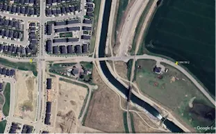
The case study involved surveying approximately 467 meters of sanitary trunk main infrastructure to confirm tunnel positioning, pipe geometry, and available clearance relative to proposed bridge abutment construction. The collected data was processed into CAD-ready mapping and hydraulic assessment information.
Key Contributions
High-accuracy underground pipeline mapping using integrated sensor technologies
CAD-ready positioning and pipe alignment data
Hydraulic characterization and pipe geometry analysis
Identification of underground infrastructure clearance constraints
Accurate pipe meander mapping and elevation tracking
Infrastructure Implications
Accurate underground pipeline mapping supports infrastructure planning, bridge and utility coordination, maintenance scheduling, and risk reduction during excavation and construction activities.
Integrated survey data can also improve hydraulic analysis, identify potential system vulnerabilities, and support more informed engineering decision-making for aging underground infrastructure systems.